


5 walks you won’t want to miss in Panama
We Panamanians love saying, “If you don’t like Panama’s weather, wait a few minutes” in regard to the country’s changing weather conditions, but the truth is that we have two main seasons: the first eight months of the year, with frequent strong and fast rains and sudden tropical storms, interspersed with moments of intense sunshine, and the second four months, with lots of sun and colorful sunsets. From late December through the end of April, we have a chance to enjoy the beautiful tranquility of the outdoors without worrying about a sudden storm. The question is: how best to take advantage of the summer weather in the city?
By Julia Henríquez
Photos: Javier Pinzón
A walk along Paseo Huertas
What is it?
A scenic walkway on top of the seawall, which was built in the 17th century to protect the city from outside attacks. The paseo, or promenade, links Plaza de Francia with the recently opened Hotel Sofitel Legend Casco Viejo.
Where is it located?
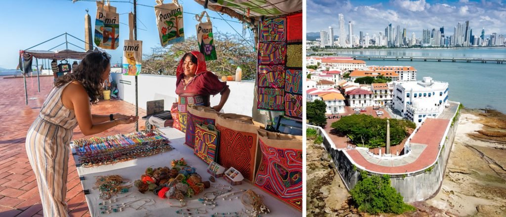
In Panama City’s renovated Casco Antiguo neighborhood, where you’ll definitely want to spend at least one day during your visit to Panama.
How best to walk it?
Begin your walk in the Plaza de Francia, along the semicircle under the stairs, where you’ll learn about the brief but complex relationship between France and Panama, which lasted from the birth of the idea of the Panama Canal until the arrival of the United States. Climb the steps that surround the obelisk dedicated to France and fall in love with the landscape.
What is there to see?
On your right, the Amador Causeway and the ships waiting their turn to enter the Panama Canal; in front of you, the Pacific in all its glory and the Cinta Costera 3; and, finally, to your left, the city and its majestic skyscrapers. Don’t forget your camera as you’ll have a chance to take beautiful snapshots of both the landscape and the tunnel of summer flowers at the end of the tour. Afterward, spend some time walking through the Casco Antiguo with its beautifully restored hotels, where visitors are welcome to enjoy the social spaces and the hotel restaurants and bars. The neighborhood also boasts historic squares lined with exquisite restaurants, craft breweries, and terraces with bars for an ideal ending to your day.
Paddleboarding in Veracruz
What is it?
The closest beach to Panama City. After several years of neglect, it has returned to its former glory with the arrival of several surfing and paddleboarding schools and a couple of bars.
Where is it located?
Fourteen miles from the city center, take the first exit on the right after crossing the Bridge of the Americas. It’s the perfect place for those looking for sun, sand, and surf without going too far from the city.
How best to walk it?
In addition to admiring the beach and eating ceviche and patacones accompanied by a good beer, in Veracruz you can rent surfboards and stand-up paddle boards for some fun. No experience is necessary; these places employ professionals who provide basic instructions before they let you hit the water.
What is there to see?
The best sunsets around! Don’t let the wind or your eagerness to return to reality scare you off! Wait for sunset and get lost in the play of orange light that takes over the sky and dances in the reflection of the waves.

Enjoy Amador
What is it?
A causeway across the sea that connects the mainland with the islands of Naos, Perico, and Flamenco and serves as a breakwater for the Panama Canal. Built between 1904 and 1914 from materials extracted during the canal excavations, the causeway was also the site of a U.S. military fort. After the canal was returned to Panama, it was repurposed for public enjoyment. It was expanded and remodeled in 2019.
Where is it located?
The Amador Causeway is the Pacific entrance to the Panama Canal. It is located in the south-western corner of the city, in what was formerly known as the Canal Zone.
How best to walk it?
Although you can travel the causeway by car, it’s more fun to walk or bike the 3.7 miles of designated paths, stopping on each of the islands.
What is there to see?
The Biomuseo: The building designed by Frank Gehry is an attraction in itself, but the interactive exhibition inside explains the im- portance of the emergence of the isthmus from the bottom of the seas.
Punta Culebra Nature Center: located on Isla Naos, this interactive nature center teaches visitors about marine life based on the research carried out by the Smithsonian Institute in the country.
Isla Perico has a large children’s park, a go-kart track, and an outdoor photo exhibition of Panama on Isla Flamenco, in front of a dock with luxurious yachts and a variety of culinary options.

Bike along the Cinta Costera 3
What is it?
The Cinta Costera is a five-mile promenade bordering the Bay of Panama that has become a major public recreation space. It has playing fields, playgrounds, gardens, outlook points and, above all, family bike rentals and an excellent cycle path. The promenade’s final section, known as the Cinta Costera 3, is a 2.7-mile marine bridge that encircles the city’s Casco Antiguo district and ends in the El Chorrillo neighborhood.
How best to walk it?
If you’re in good shape, start pedaling at the beginning of the Cinta Costera in the Paitilla neighborhood. Otherwise, we recommend you start at the Mercado del Marisco (Seafood Market) and save your strength for the marine bridge.
What is there to see?
The best views of the old part of the city from a perspective previously exclusively available to those who arrived by boat. Stop at the tourist decks —circular lookouts perched above the water and equipped with sun loungers and binoculars— and take all the time you need for your selfies. End the tour with a gastronomic re- ward at Sabores del Chorrillo, an enterprise organized by the neighborhood’s traditional cooks, and savor the best of the local cuisine: fried fish and plantains.

Visit Taboga
What is it?
Taboga is the island in the Gulf of Panama closest to the city, which offers a heavenly panoramic view. At low tide, a long, wide sandbar opens up, connecting the main island with the tiny El Morro islet.
Where is it located?
Less than twelve miles from the city, just a short ferry ride away. From the moment you leave the pier in Amador, this is a spectacular trip, thanks to the view of the city and the chance to see dolphins, or at least flocks of seagulls flying behind the boat.
How best to walk it?
Enjoy the beaches, dive into the sea, or climb the island’s peaks. The island is also known as Isla de las Flores (Island of Flowers) for the elaborate gardens that line its streets. The Church of San Pedro Apóstol, built in 1685, was the second church built by the Spanish on the Pacific coast. The La Cruz and Cerro del Vigía trails, which lead to fauna and flora reserves, offer beautiful panoramic views. The island has good restaurants as well.


Leave a Reply