The Crater Route: Inner Panama
Beach tourism is well established in Panama, but what about the mountains? With La Ruta de la Caldera (Crater Route), the country’s authorities are turning the spotlight on the isthmus’s mountains by overhauling and restoring these walking trails. They’re laying out the welcome mat for a journey into the secrets of the heights and giving visitors a look at the country from a different vantage point.
By Alexa Carolina Chacón
Photos: Sira Pérez, Rubén Rodríguez, Luis Zamora
This is my first hike. I want to be clear about that from the start, since it will help you better understand this article. I think being a novice lets me describe the trip with the freshness of someone experiencing a marvelous adventure for the first time.
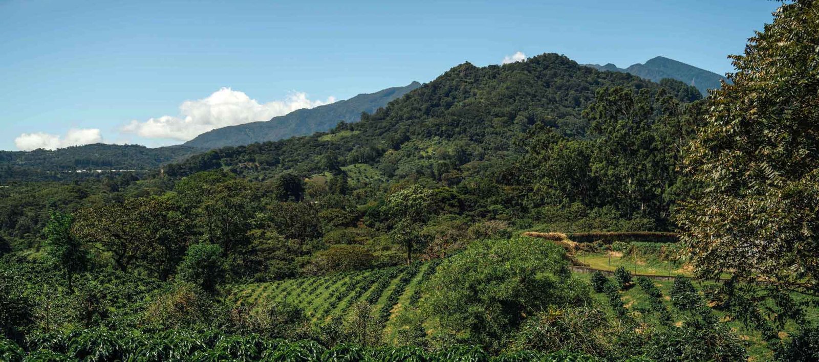
The central figure of this narrative is El Valle, a town nestled inside an ancient volcano crater surrounded by mountains. This picturesque site has played a significant part in leisure tourism in Panama. In fact, many people classify Panamanians as either “valley folk” or “beach people.” Traversing the isthmus via this route’s trails provides a perspective that diverges from the country’s popular image of sand and sea.
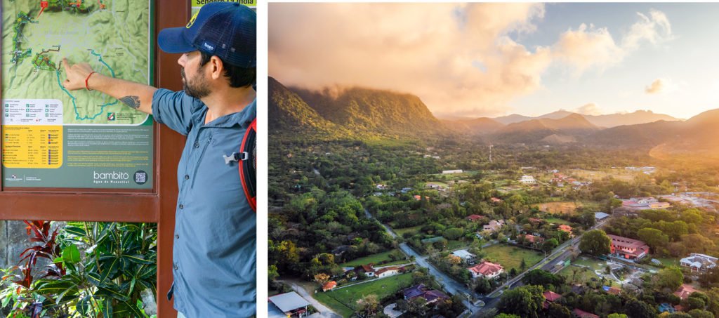
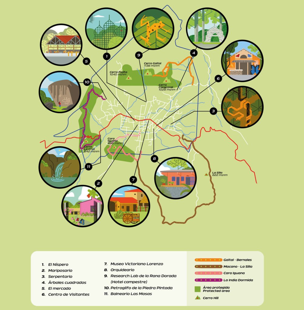
The four trails, duly sign-posted with useful information for hikers, open a window on a different Panama. They have been cleared and restored in places where nature has not been so benign. The feat was achieved by Adrián Benedetti, coordinator of the Crater Route for the Panama Tourism Authority, who made this Panorama of the Americas tour possible. The trails are: La India Dormida, Cara Iguana, Macano-La Silla, and Gaital-Los Berrales. Together they constitute the Crater Route.
A Photogenic Mount
It’s Friday afternoon and the weather is clear and cool. It’s an ideal day to take a walk in nature. Our first trail is La Silla-Macano. Limited time obliges us to begin our tour from the main road that descends to El Valle in the direction of the route’s main attraction: the summit of Mt. La Silla, where visitors enjoy the sweeping prospect of one of the area’s most popular views.
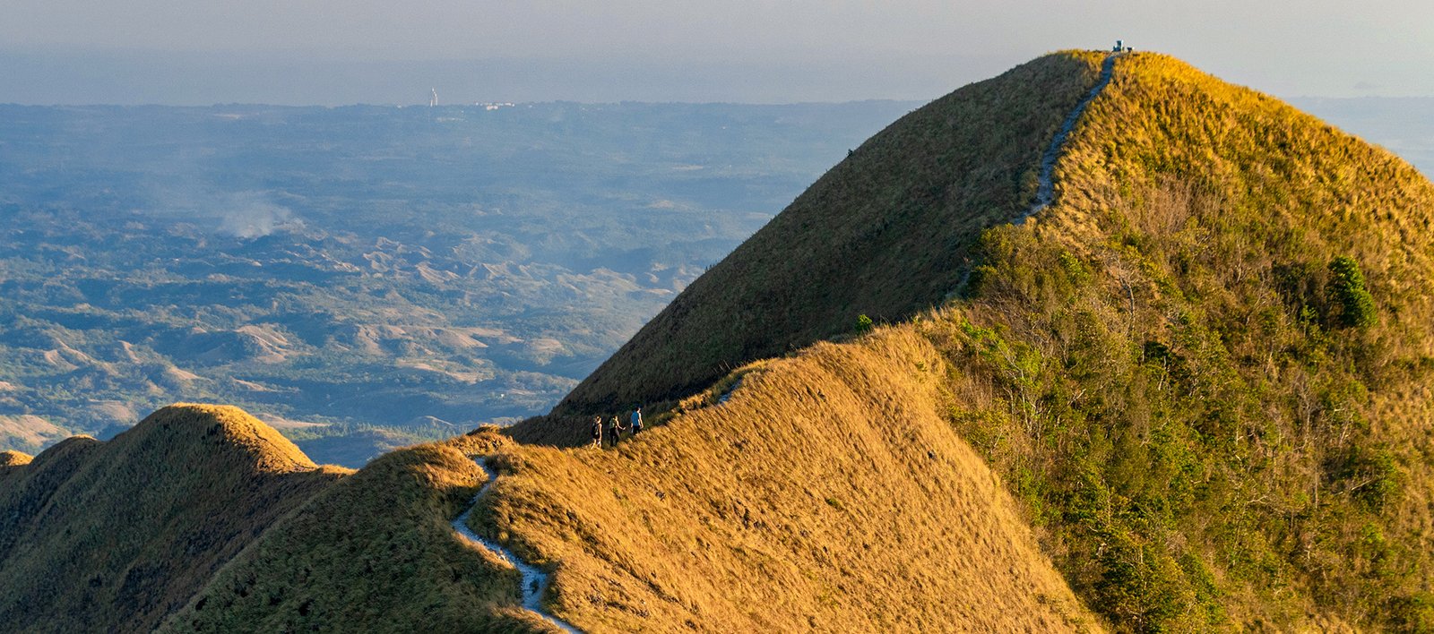
I quickly understand why photos of this trail are so often posted on social media. What began as a pause to catch our breath after the first part of the ascent turns into my first gasp of awe: my mind records the summit of the mount, the sky in gradations of pale blue, and the feeling of absorbing a panorama that encompasses many kinds of landscapes in a single view. Panama says everything without uttering a word.
I can make out the white line of the trail on the mountain, zig-zagging through the short dry grass that predominates during the summer. At one point, there is only trail and little margin for error. A thin line snaking across the mountain to the summit, with a descent through parts I can’t see yet. Just out of curiosity, I pose a rhetorical question: “I’m going to climb that?” Adrián shoots back such an enthusiastic “yes” that I urge my legs to push on upward.
The summit is topped by a huge cross that helps me pinpoint my location. I am atop Mt. La Silla, which lies in the province of Panamá Oeste. Here, I discover that the Crater Route not only encompasses El Valle, but that this spot also allows easier access to each other section of the route. The community of El Macano is visible below us. Adrián explains that hiking the nearly 6 miles of the entire trail —from El Valle to Pita, on the border of the Cara Iguana Hydrographic Reserve— is a great opportunity to visit small towns and get a feel for rural life in the area.
We move from one summit to another and discover firsthand how intimidating it feels to descend these rocky paths for the first time in the face of a howling wind. I’m learning to respect the nature around us. I descend cautiously, accompanied by my guide and a sunset in a gamut of oranges. I have never experienced anything like it. I have seen hundreds of sunsets against backdrops of buildings, but everything just looks so much clearer in the mountains. I am left wanting more. Adrián is quick to reassure me, noting that this is only the beginning of our mountain adventure.
Rustic Trails Into the Interior
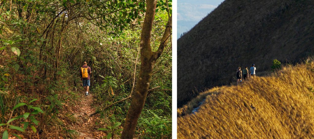
The next day, our wake-up call for the climb to Cara Iguana is at 4:30 a.m. We need to set out early if we want to photograph the ephemeral magic of the sunrise along the way. I recommend that you get up equally early, especially in the summer, if you want to watch the orange hues paint the mountains in new tones. We set out from Los Millonarios Street while it’s still dark. A flashlight and a positive attitude keep me company. My eyes gradually grow accustomed to the dimness, improving my view of the road. Even so, the flashlight makes me feel more confident about where I’m stepping. The steep ascent reveals why Cara Iguana is such a draw: the summit huddles inside the El Valle crater, allowing us to see the entire plain from above. This is the perfect place to get a feel for the town and its surroundings. As we climb, I glance to the left toward another trail on the Crater Route: La India Dormida, one of the country’s most iconic and best known.
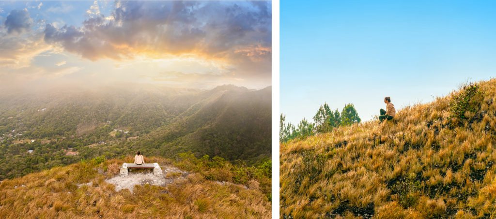
It is soon clear that Cara Iguana is the ideal trail for reinventing myself as a rambler. Since we reach the summit relatively quickly and easily, we await the sunrise from the comfort of one of the benches built by Adrián’s team. The wind reminds me of previous warnings to try to not sweat too much; the wind will chill you much more quickly if you arrive at the summit sopping wet.
The lights of the town are visible from our position, and we can hear the occasional rooster crowing. It feels special to be awake before most everyone else, particularly seeing them from above. The sun slowly slides into view on my right. Anyone who has witnessed a Panamanian sunrise during the dry season knows that it is fleeting, given how quickly the sun pushes above the horizon. All the imaginable shades of yellow, orange, and red begin to gild the trees on the mountains before us. I spot details I hadn’t noticed a few minutes earlier. We revel in a splendid 360° view from Cara Iguana.
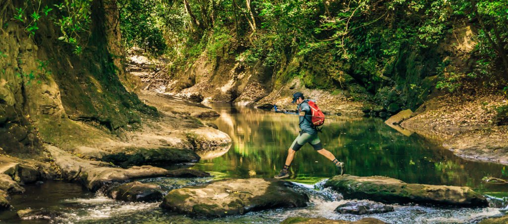
The descent from Cara Iguana feels rather like being in a Star Wars movie: many worlds in one galaxy. Hikers go from a zone of only dry grass to strolling among pines and fog, and then to feeling humid earth under their feet in a plot of nature gone tropical. It’s all part of our descent on roads marked by paint or barriers of stones; even I, who have never done anything like this, understand the markings as stop signs. Every so often, when I stop and look at the road behind us, I am surprised to see that we have already descended along the narrow ridge of the mountain.
Even so, I felt myself in no danger. Along the way, Adrián explains that from here we can reach Cabuya, a community that boasts a spectacular and well-established adventure circuit.
Our outing ends in El Valle, near Las Medinas. Owing to our stops for photos and videos, the trip lasted four hours. Without these pauses, the walk would take considerably less time. We covered nearly 2 miles of the full 4 miles of trail. Perfect for novices. The end is bittersweet. Our joy over coffee and breakfast was tinged with regret that there was still so much more beyond what we had already seen. We ached to discover the mountain’s remaining secrets. An excellent reason to return.
A Community Resource
The Crater Route is a sterling example of Panama’s potential as an adventure tourism destination. The great achievement of Adrián Benedetti and his team is to have marked, built, and equipped old trails with infrastructure that makes it possible to enjoy them without a guide. This is a natural fit with ecotourism and community tourism, given its development in the country’s protected and rural districts. The idea is to ensure that the communities get a return on their investments in the trails. While descending the Cara Iguana trail, Mr. Benedetti shared that the community comes together to keep the trail clean and even to widen it.
Adrián dreams of a sustainable cycle in which the communities organize to provide tourism services that will generate income for them. El Valle exemplifies the success needed to push further: marking and bringing infrastructure to more than 600 miles of trails around the country.

Leave a Reply