Transcontinental Expedition: Changing Lives
Text and Photos: Javier A. Pinzón
This story begins in the Pacific, an enormously diverse nutrient-rich ocean that covers a third of the Earth’s surface and forms one of the world’s largest fish reserves. I am part of a group of ten young people about to embark on a four-day discovery of the contrasts, diversity, and cultures along the 52-mile stretch of land that separates the Pacific from the Caribbean Sea. We’ll cross the continent’s narrowest and youngest strip of land, which rose up out of the ocean millions of years ago, joining land masses and separating oceans, causing such global climate change that scientists now believe the event made it possible for hominids to evolve into what we are today.

The crossing will employ several means of transportation: a boat along the Pacific coast at the beginning; a canoe through several stretches of mangrove; a bike in more populated areas; good old-fashioned feet up the most difficult slopes; and a kayak to navigate the rivers. The journey starts at the exit from the Panama Canal, in a 23-foot boat that will take us to a small town east of Panama City.The sun is barely up and the group is quiet. There is excitement and anxiety in the air, but also an attitude of contemplation. Several of my companions are facing their first long journey through the wilds of nature.
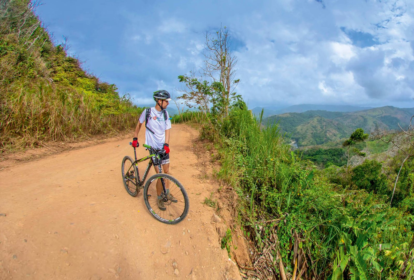
It’s time to board our canoe, which awaits us in an inlet, and cross the mangroves in the Bay of Panama, a little less than a half mile. Declared a Ramsar Site, these mangroves are one of the planet’s most valuable ecosystems and breeding grounds for a large number of marine species, which is why they are often referred to as a fish nursery. We perform a small ceremony, collecting a little water from the Pacific in order to return it, at the end of our travels, to the Caribbean Sea, reuniting waters separated millions of years ago. We move through a labyrinth of mangrove roots until we reach the fishing village, where we climb onto our bicycles for the first time. Locals send us on our way with music and we ride onto the highway.

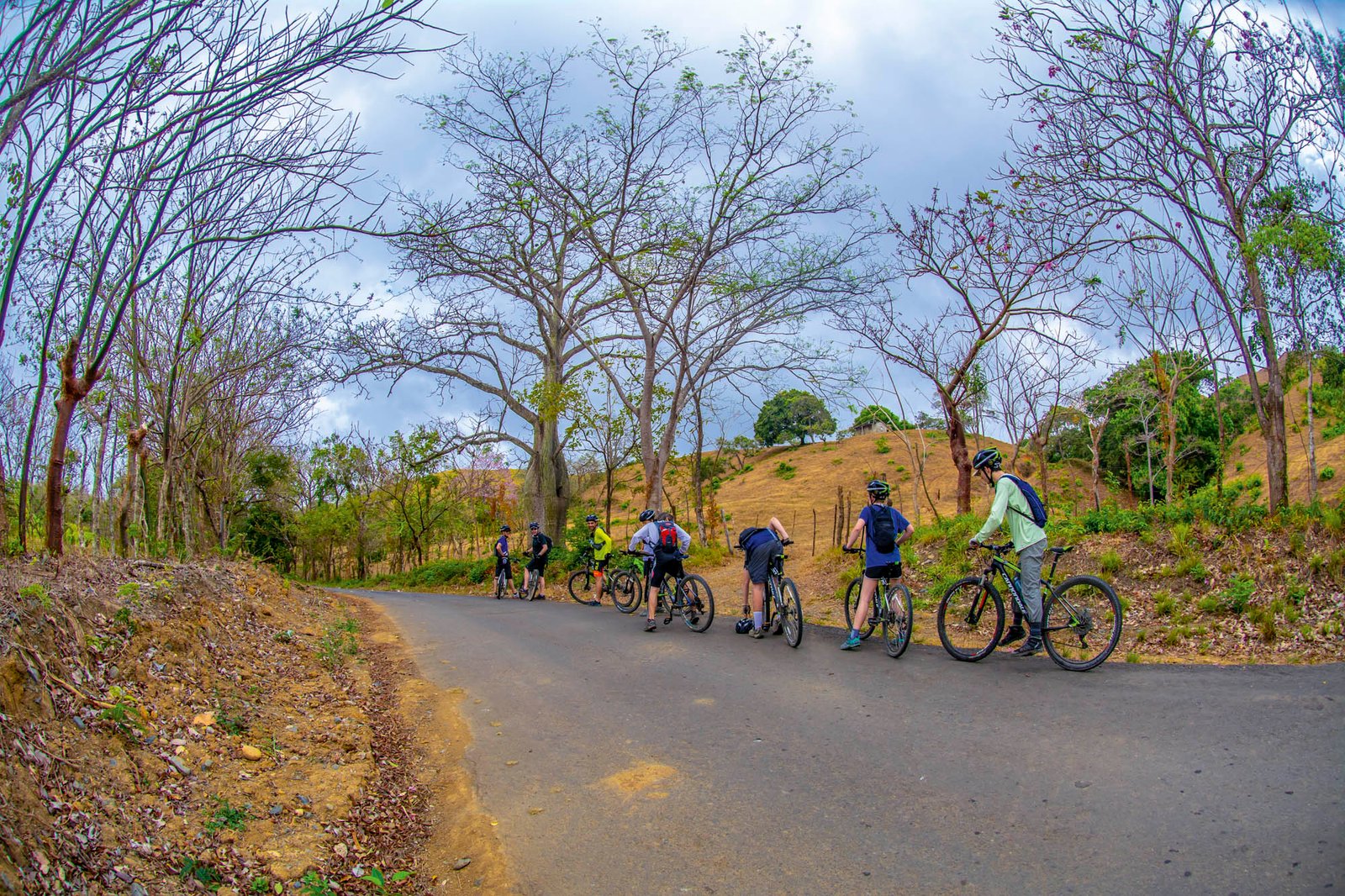
The landscape at the beginning of the trip is arid. It’s the dry season and this is a dry forest, but there’s more to it: this drought is due mainly to the harmful environmental effects of livestock production. There are very few trees and the heat is intense. We take a well-deserved rest at noon to enjoy a lunch wrapped in bijao leaves, safe in the knowledge that we’ll leave only biodegradable materials behind. That afternoon, we cross several refreshing streams and as the day ends we come to the great Bayano River, which we cross by boat. Geoversity’s Director of Conservation Affairs, Líder Sucre,is a graduate of the Harvard School of Business and the best nature guide I’ve ever had the pleasure of following. He points to a cocoi heron, endemic from Panama down to Tierra del Fuego, drinking quietly from the waters of the Bayano, and explains that the cocoi is very similar to the blue heron (minus its black tuft), found from Panama up to Canada, which is convincing proof that Panama is a biological bridge between two continents.
We cross the river and arrive at Chepo, a town of 46,000 inhabitants, and the tranquility of the open road disappears into the noise of traffic and loud music. We’ll make our first stop here, at the Yayita Riverside Lodge. After a well-deserved shower, an excellent meal, and a timely examination by our paramedic, Claribel Vanessa Samudio, it’s off to sleep.

The next day, Nathan Gray, executive director of Geoversity and co-founder of Mamoni Valley Preserve (MVP), reminds us that this is not just an adventure; it’s a chance to see and experience what is happening to nature. Nathan, a seasoned social leader, has worked in youth leadership for more than forty years. He helped found Geoversity, an ecosystem of leaders and organizations collaborating in the pursuit of nature-inspired breakthroughs in human design, enterprise, and creative expression. We return to our “steel horses” and the highway; the Pan-American Highway no less, running from one end of the continent to the other for nearly 30,000 miles, interrupted only for approximately 80 miles in the Darien jungle, not far from here. The paved road leads us gently to our next destination: the green mountains off in the distance.

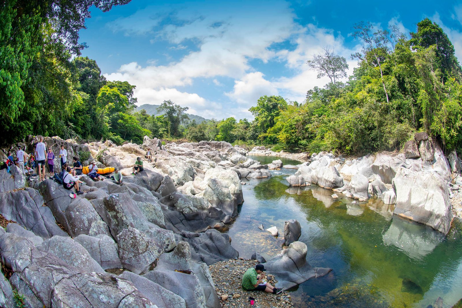
We eventually make it. There are difficult hills to climb, but we are spurred on by the words of Claus Kjaerby, Geoversity’s Director of Operations:”Keep going! You have to keep going. Give it everything you’ve got until we reach our goal.” There are descents between hills, and coasting downhill is always easy. Fun even. However, there’s inevitably another hill to climb, reminding us that this trip is no cakewalk. Along the way, we meet Iniquiliqui, leader of the Guna Youth Congress, and Anna Gili, Director of Experience Mamoní, which operates in the middle of Geoversity’s 12,000-acre private reserve called Valle del Mamoní,whose vision is to turn this huge private reserve into a peaceful global haven, where plants, people, and animals from all over the upper Mamoní valley coexist harmoniously in a thriving rainforest environment. Near the end of the day we reach the Mamoní River in all its splendor, out of whose crystal clear waters emerge enormous rocks in fascinating colors and shapes.

Another two hours on our bikes and we arrive at Mamoní Experience, an eco-learning adventure deep in the rainforest, created to provide a different experience. The facilities have been built from wood and bamboo and blend in with the surrounding forest, inspiring relaxation.
Day 3. The sky is overcast and there is a sense of expectation among my companions. A six-mile hike awaits us. The first few miles are a long, tortuous climb. The rain forest embraces and delights us with thousands of different sounds.
The group remains silent. It requires concentration and effort to reach the top. Finally, we arrive at the continental divide, where rivers choose their course, either toward the Pacific or the Caribbean. But it isn’t only a division of waters, this spot marks the separation of two worlds. We leave behind the Western world and venture toward the indigenous Guna nation, which has its own worldview. And the former world is destroying the latter’s way of life. The world we have just left behind created global warming and the Gunas, who have lived for centuries on small islands, are now being forced to move to the mainland, as rising sea levels causes their spectacular archipelago to sink.

This is as far as Nathan goes with us. His farewell is lapidary: “Don’t wait for adults to clean up the mess; young people must take action now and the adults will follow your example. Don’t just accept the future they left us; take action to create the future you want.”
Next comes the Cangandi River, where our friends from Experience Mamoníare waiting with kayaks, our next means of transportation. After a brief explanation of how to handle the vessels and the signals we’ll be using, we get started. The river moves us swiftly through the middle of a primary forest. The water isn’t very deep due to the El Niño phenomenon and at times we’re forced to get out and push. Calm stretches of the river allow for contemplation and we enjoy the surroundings, listening to howler monkeys and watching herons go by. But soon we approach rapids and are forced to get out of our kayaks again, and then it’s back to paddling until, eventually, the calm returns.
At dusk, we reach a camp set up by our friends, the Gunas: hammocks in the forest. A quarter moon hangs in the sky. While Claus cooks over a wood fire, I search for Orion among the constellations. Frogs and cicadas begin their all-night concert. But just as I am feeling far from civilization, the sound of an airplane reminds me that very few pristine places remain on this planet.

Day 4. The jungle wakes, birds sing here and there, the river awaits. We have a long boat trip ahead of us to the Gan Igar community, one of the few Guna settlements on the mainland. The river is kinder today; on only a few occasions are we required to get out of the kayaks. We come to a beautiful ten-foot waterfall and form a line to pass the kayaks over to the other side before taking a dip and moving on. Two hours later, we arrive at Gan Igar.
The “saila” or leader, Manidinkipe Walton, welcomes us and explains a little about his culture. I purchase a mola dress for my little Isabella. Molas are fabrics stitched with complex designs and multiple layers using the reverse appliqué technique. We can’t stay long though because there’s still a long way to go.
And so, backpacks over our shoulders, we walk for an hour until we reach the mangroves. There, we are met by typical Guna rafts, three quite large and another smaller, narrower one. I dare to choose the smaller one and soon realize how difficult it is to handle. I marvel at the mastery of my Guna companion at the helm. I try to help, but my movements alone bring water into the vessel and my partner is forced to bail, slowing us down even more.

No longer feeling my legs, I finally spot the opening to the sea… “Just a few more strokes of the paddle and we’ll reach the Caribbean, our own little piece of the Atlantic,” I thought, spurring myself on.
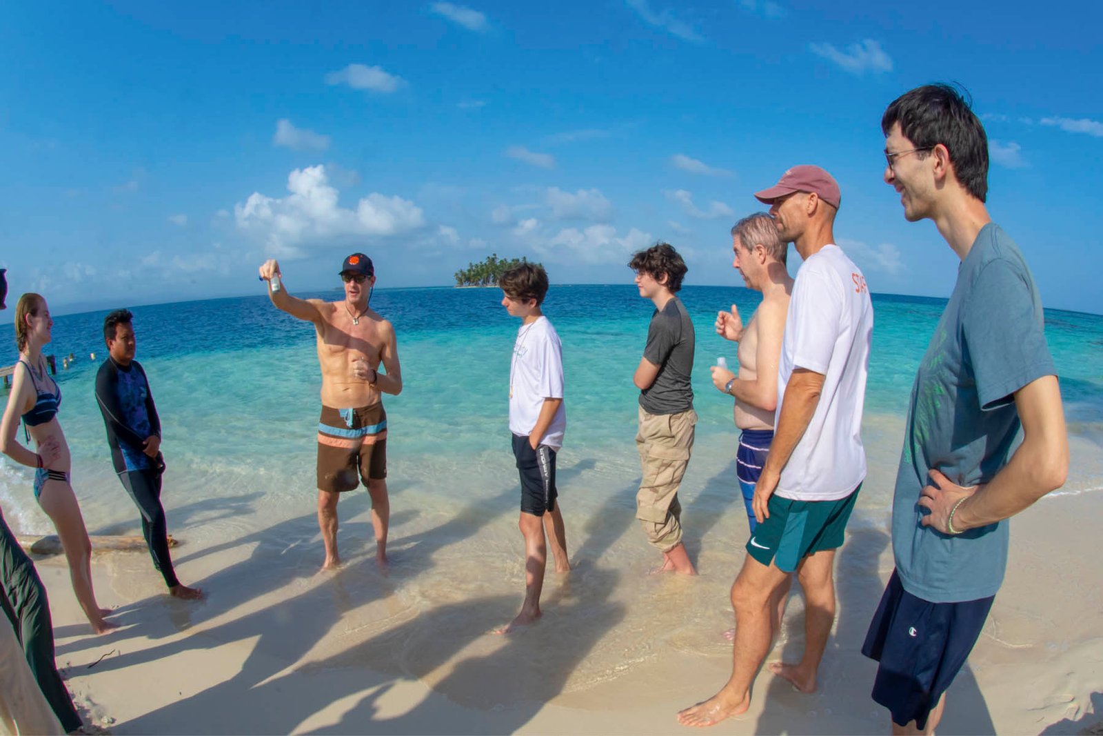
Finally, we reach our destination, the Guna Yala province on the shores of the Caribbean Sea and enjoy a quick swim before heading for our final stop: the island of Guanidup and its soft white sand beaches.


