

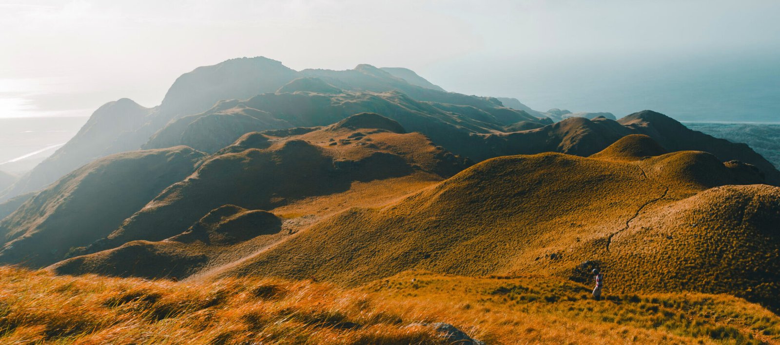
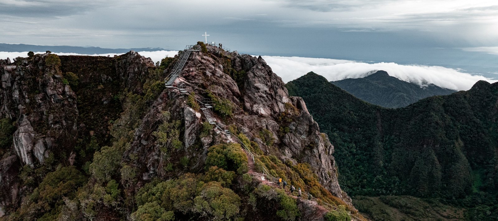
Mountains, Panama from a Higher Vantage Point
Panama City is in the enviable position of being surrounded by lush, unspoiled greenery. The national parks that cradle the capital are complemented by several mountains near the city that offer a different world of humid trails, cloud forests, native fauna, camping options, and adventure tourism. During your visit to the Hub of the Americas, make sure to step away from the skyscrapers of the concrete jungle to experience the giant trees of the tropical rain forest.
By Alexa Carolina Chacón
Photos: Rommel Rosales
When people ask me what makes Panama so special, my answer is always the same: the capital’s proximity to natural paradises. While “paradise” means different things to different people, any Panamanian will tell you that the wealth of Panama lies in its green gold. Its lush mountain jungles shelter native species, animals in their natural habitats, and waterfalls that refresh the trails and add a touch of romance to the rivers. A good way to experience this is to head out on the mountain trails near the city. The exceptional panoramic views of nature can be enjoyed on day trips, if you’re short on time. Panama’s palette of colors and temperatures shifts at these heights, revealing treasures that seem especially fanciful considering how close they are to urban centers and wide highways.
Here we present a list of five mountains and their trails, where noise falls away and Panama is no longer a sealevel country.
Even experienced hikers should be mindful of the safety measures recommended for each trail. You’ll need to wear shoes suitable for walking on damp ground, and you should always carry water, a hat, and sunblock.
La Cruz Mountain
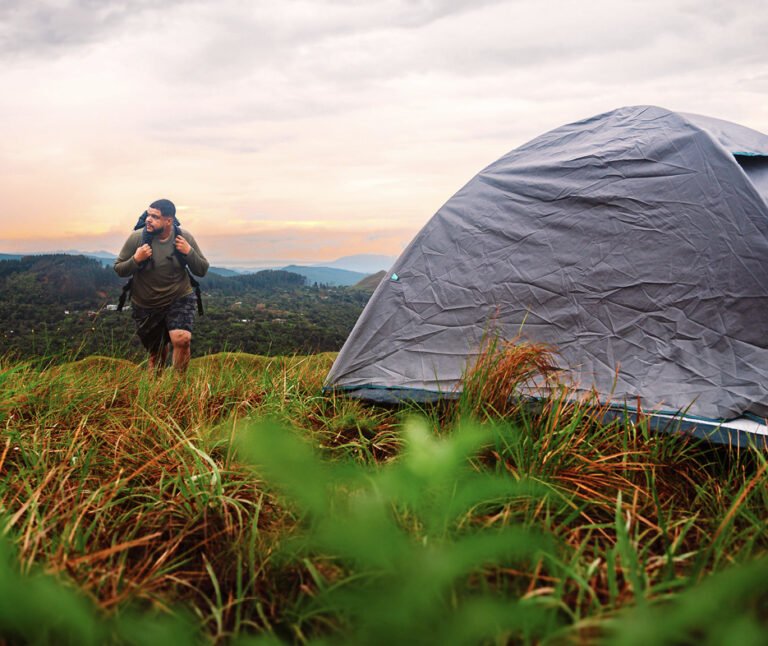
Although Mt. La Silla is reached via the entrance to the Antón Valley, it stands in the province of Panamá Oeste, the San Carlos district to be specific. It offers easy access to mountain adventures, making it a classic destination for hikers, cyclists, and runners. La Silla, sometimes confused with Mt. La Cruz owing to the religious symbol on one of the summits, is part of the Crater Route, a circuit of trails running through the mountains surrounding the crater that embraces El Valle. The complete tour covers 5.8 miles and connects with communities like El Macano. However, you can drive up to the antennas, park, and hike to the two closest peaks. The mountain is covered with low vegetation, leaving you at the mercy of the vagaries of the weather. This is also a wonderful place to camp in the moonlight. The vista encompasses the Pacific Ocean and the shoreline over which the sun rises, creating a transcendent spectacle.
Where?
Panamá Oeste, enter via El Valle
Total distance: 9,4 km / 5.8 miles
Route duration: 20 minutes from the antennas to the cross and the nearby peaks
MT. PICACHO AT
SAN CARLOS LAKE
About two hours from Panama City lies San Carlos Lake, a natural site that enhances the beauty of the Pacific Riviera, known far and wide for its beaches. Many people are unaware of the green tourist attractions available just up the mountain from the highway. If you turn right before Coronado, a 40-minute drive will take you to this body of water, which has long been a favorite for family trips and camping. A sign planted amid wild vegetation at the entrance points the way to the trail to Mt. Picacho, the perfect viewpoint for admiring the lake from above. Walking the full route, just over two miles, takes an hour and forty-five minutes through dense greenery. Nearby cascades like Las Filipinas are part of a waterfall circuit that rounds out a visit to this area.
Where?
San Carlos
Total distance: 3,5 km / 2.2 miles
Route duration: 1 hour and 45 minutes

The “1000 Km of Trails” project has restored existing trails and created new routes to connect the surrounding communities. Thanks to these types of initiatives, trails like those on the Crater Route have been cleared and sign-posted.
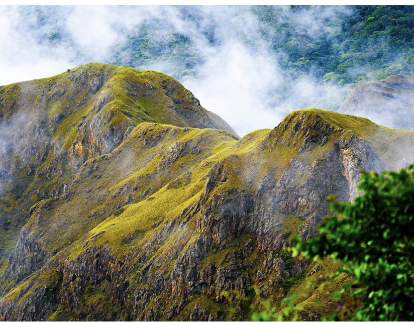
Mt. La Cruz
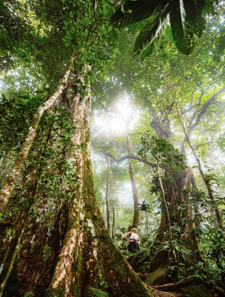
The Altos de Campana Biological Reserve sits an hour away from the city (except at rush hour) and boasts many more wonders of nature than you can see from the highway. Located in the Capira district, this national park is a key component of the Mesoamerican Biological Corridor and one of the country’s most important green lungs. Join me at Mt. La Cruz, one of the area’s most magical, accessible, and powerful mountains. A walk down the street toward the entrance will take you to the Mi Ambiente checkpoint, where the park ranger will help you complete the registration process required for entry. The trail is humid and gets damper and mistier by the minute, so make sure you’re wearing proper footwear. Don’t forget to stop and look up as you enjoy the trail. As you appreciate how the light filters through the leaves, you’ll undoubtedly spot some of the species of birds that make their homes here. Relish the feeling of standing at a viewpoint nearly three thousand feet above sea level. This vantage point looks toward Mt. Campana (rising to 3380 feet), another breathtaking option for seeing Panama from above.
Where?
Campana
Total distance: 3,5 km / 2.2 miles
Route duration: 1 hour and 45 minutes
Mt. Gaital
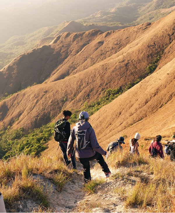
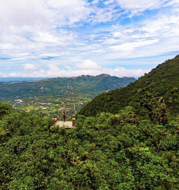
Head out from town to the Mt. Gaital Natural Monument, one of the most celebrated stops on El Valle’s Crater Route. After the customary registration process, hike uphill along a wellmarked, unobstructed section of trail. Stairs will take you to a fork in the road: the path to the right is shorter, but steeper and more arduous. The one to the left is longer, but less demanding. We chose the latter option, but as expected, the Panamanian mountains still challenged us. “1000 Km of Trails” team made sure that the trail to Mt. Gaital, along with the rest of the Crater Route, was sign-posted and equipped with strong cement benches on which to rest and admire the scenery. Less than an hour of walking deposits you at the viewpoint located between the two peaks, providing a panorama of El Valle in all its splendor. The summit of Mt. Gaital repeatedly comes into view along the way, but as a sign sagely advises: don’t go any further without a guide, good physical condition, and rappelling gear.
Where?
Antón Valley
Total distance: 4 km / 2.2 miles
Route duration: 1 hour and 45 minutes
Mt.Chame
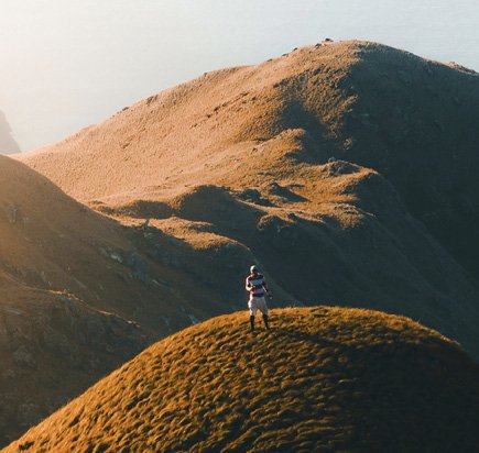
Mt. Chame reaches 1814 feet above sea level. The relatively modest height might lead you to think that it’s an easy climb, but the difficulty and the appeal of this mountain have little to do with the altitude or the luxuriant trees. The pleasure of climbing Mt. Chame lies in the long walk along the mountain ridge and the opportunity to revel in natural phenomena that differ greatly from those of the other mountains. Here the grass is short and turns golden under the summer sun. Visitors can reach Mt. Chame via the Bejuco community or Punta Chame. The road is sign-posted and easy to follow. The first section runs through a shady forest, something you’ll appreciate as you advance farther along the trail. The actual ascent to the summit begins halfway along the trail, at which point the surroundings change. You leave the forest canopy behind, meaning it’s just you and the weather of the day. The 360° panorama available from the summit is a sight few others can match. On one side lies Altos de Campana National Park, and on the other, the Pacific Ocean in the form of Chame Bay.
Where?
Chame
Total distance: 8 km / 5 miles
Route duration:
3 hours
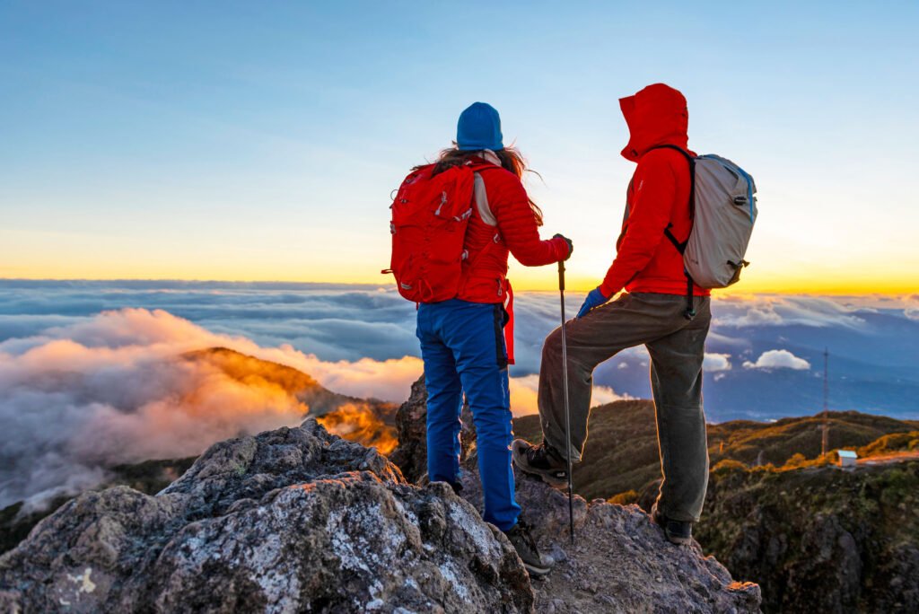
Barú Vulcano, the most special top
It is not close to the city and it is not a hill either, but an article that highlights Panama from above would lack soul if we did not mention the Barú volcano, the highest peak in Panama and the fifth highest volcano in Central America. From Volcán, in the Tierras Altas district in Chiriquí, is the most difficult climb. This option is imperative to undertake with a guide. The easiest access is in the Boquete district: walking will take four to seven hours, and there is the option of going up by 4×4, which will take one hour. On clear days, you can see both the Pacific Ocean and the Caribbean Sea, an unforgettable experience that can only be experienced in Panama.

Leave a Reply